NSW 9238-4N – Rangers Valley For Cheap
Description
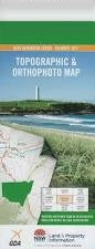
This Topographic Map is produced by the New South Wales Government.
This map is supplied in digital in PDF format, which means it can be printed at home or sent to a professional printer for a 100% scale reproduction.
At this scale, 4cm on this map represents 1km on the ground. A standard map (which is square) covers an area of approximately about 12.5km by 12.5km, with a contour interval of 10m. This map contains natural and constructed features including road and rail infrastructure, vegetation, hydrography, contours, localities and some administrative boundaries.
Moorlands Severn Valley Broadwater Eulabury Glenoak Rangers Valley Kensilgrove Coolaball Fern Hill Brydone Koro Lirzbends Middle Lea Sunnybrook Oslo Balmoral Gaza Glendon Spring Grove Back Plain Creek Back Plains Creek Camerons Creek Clarkes Mountain Clarevaulx Lagoon Fladbury Fladbury Mountain Gibsons Gully Gordon Isolation Jackys Knob High Mountain Lighthouse Lighthouse Hill The Lighthouse Mccarthys Creek Mccarthys Gully Rabbit Reddeston Creek Reddestone Creek Reed Swamp Creek Reedy Creek Reedy Swamp Creek Rummerys Hill Spicer Stoney Creek Stony Creek Teatree Gully Twin Mountain Twin Mountains Vivier Wellingrove Wellingrove Creek Wellington Bullock Bullock Mountain Dog Trap Gully Reddlestone Creek Clarke Mountain Beardy Waters
Additional Information
| Title | Pdf Download |
|---|
Related products


Information
Customer Care
Other Business
Newsletter

linkresortus.shop © 2025 All Rights Reserved