NSW 9037-3N – Piedmont Online Hot Sale
Description
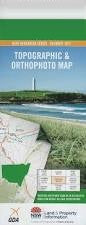
This Topographic Map is produced by the New South Wales Government.
This map is supplied in digital in PDF format, which means it can be printed at home or sent to a professional printer for a 100% scale reproduction.
At this scale, 4cm on this map represents 1km on the ground. A standard map (which is square) covers an area of approximately about 12.5km by 12.5km, with a contour interval of 10m. This map contains natural and constructed features including road and rail infrastructure, vegetation, hydrography, contours, localities and some administrative boundaries.
Oakey Glen Nevada Rose Valley Rose Hill Coowong Rosedale Gossanbar Tabletop Bundaler Bells Mountain Gundamulda The Forest Jimbour Brooklyn Kyooma Doonba Angle Camp The Glen Treboraine Messines Calamondah Tiabundie Bareela Wyndella Appleton Tipperina Adams Lookout Barraba Broadbecks Creek Chain of Ponds Creek Connors Creek Dennis Hill Glen The Jump Up Mille Creek Millie Creek Nandewar North Barraba Oaky Creek Paling Yard Creek Paling Yard Diggings Sawpit Gully Sheep Station Creek Spring Creek Station Creek Stringybark Gully Sugarloaf Hill Tabletop Hill The Basin Bullock Yoke Gully Little Plain Swamp The Little Plain Bells Mountain Camp Bells Mt Camp Hawkins Creek
Additional Information
| Title | Pdf Download |
|---|
Related products


linkresortus.shop © 2025 All Rights Reserved