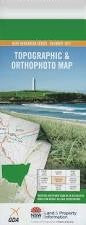
NSW 8828-3S – Inveralochy on Sale
Description
This Topographic Map is produced by the New South Wales Government.
This map is supplied in digital in PDF format, which means it can be printed at home or sent to a professional printer for a 100% scale reproduction.
At this scale, 4cm on this map represents 1km on the ground. A standard map (which is square) covers an area of approximately about 12.5km by 12.5km, with a contour interval of 10m. This map contains natural and constructed features including road and rail infrastructure, vegetation, hydrography, contours, localities and some administrative boundaries.
Bangalore Creek Brown Carneys Creek Clanceys Creek Covan Covan Creek Currawang Deep Gully Flat Creek Gordons Creek Lake Irwin Currowang Flat Gully Gordons Gully Inveralochy Railway Station Inveralochy Siding Komungla South Lake Bathurst Cemetery Long Gully Mangamore Merigan Creek Mulwaree Ponds or Creek Mulwaree River Nannys Creek The New Country Water-Holes Paddy Ryans Creek Paton Reedy Creek Reedy Gully Rose Lagoon Ryan Saltpetre Creek Springfield Springfield Public School Spring Valley Spring Valley Creek Tarago Tarago Creek Tarago Lagoon Telegraph Hill Trinton Park Creek Willeroo Willow Tree Creek Wollogorang Inveralochy Bullamalito Quialigo The Hermitage
Additional Information
| Title | Pdf Download |
|---|
Related products


linkresortus.shop © 2025 All Rights Reserved