GA 7035 – Lake Charles Hot on Sale
Description
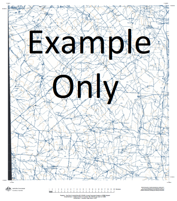
This Topographic Map is produced by Geoscience Australia; Australia s national geospatial organisation.
GA topographic maps (many of which are produced in partnership with the Army) are generally older than those maps produced by the State Governments over the same area. This makes GA maps particularly useful for identifying historic features, such as old mines and diggings.
Geoscience Australia maps generally considered to be more pleasing in design and compilation then the more modern State Government productions.
At this scale, 1cm on this map represents 1km on the ground. A standard map (which is square) covers an area of approximately 54km by 54km, with a contour interval of 20m. This map contains natural and constructed features including road and rail infrastructure, vegetation, hydrography, contours, localities and some administrative boundaries.
Please note the date of the map, as this will impact the currency of information, particularly regarding infrastructure, roads, etc.
Bore Dam Corona Dam Furlough Dam Kidman Bore Watson Bore Orange Dam Burmah Dam Buckland Bore New Chum Dam Furlough Tank Lockhart Bore Canegrass Dam Pinery Catch Windbag Dam Yalu Dam Swamp Dam Mercer Dam Oban Tank Banavie Bore Buckland Tank Purnamoota Lake Charles Wallace Bore Rosetta Dam Corona Bore Lake Dam Mosquito Dam Lake Wauwauba Mudros Extension Tank Chocolate Dam Flint Dam Stephen Creek Glenroy Bore Jacks Reward Dam Crabb Tank Cartspring Dam Hempson Catch New Kalabity Dam Child Dam Jack Dam Birksgate Bore Togo Dam Hempson Dam Wallace Dam Little Bore Dam Charlies Aunt Dam New Chum Bore Billeroo Tank Stirling Dam Curse Dam Watson Tank Lemnos Swamp Mudros Dam Pinery Hut Curse Tank Lake Charles Bore Williams Dam Furlough Bore Berber Dam Buckland Tanks Deferred Dam Oban Bore Morphetts Creek Lake Mulyungarie Calico Creek Mingary Creek Oonartra Creek
Additional Information
| Title | Paper, Laminated |
|---|
Related products


linkresortus.shop © 2025 All Rights Reserved