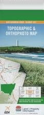
NSW 8927-3N – Corang on Sale
Description
This Topographic Map is produced by the New South Wales Government.
This map is supplied in digital in PDF format, which means it can be printed at home or sent to a professional printer for a 100% scale reproduction.
At this scale, 4cm on this map represents 1km on the ground. A standard map (which is square) covers an area of approximately about 12.5km by 12.5km, with a contour interval of 10m. This map contains natural and constructed features including road and rail infrastructure, vegetation, hydrography, contours, localities and some administrative boundaries.
Angels Falls Angel Creek Admiration Point Backhouse Creek Belowra Creek Mount Bibbenluke Bibbenluke Walls Booran Creek Broad Creek Broad Gully Broula Brook Budawang Range Canowie Brook Castle Creek Castle Gap Castle Head The Castle Cockpit Swamp Mount Cole Cooyoyo Creek Corang Corang Arch Corang Peak Crooked Falls Darri Head Darri Pass Dendrobium Creek First Curradux Creek Flying Fox Gully Freeman Creek Goodsell Basin Goodsell Creek The Gulf Kalianna Ridge Campus Head Castle Flat Castle Point Demon Scrub Denrobium Creek Mount Fletcher The Gorge Great Natural Arch Mount Irambang Korra Hill Long Creek Longfella Ridge Long Gully Meakins Pass Middle Curradux Creek Mongarlowe Monolith Valley Mount Mooryan Mother Mcdonalds Creek Murrumbooie Creek Murrumbooie Falls Nettletons Creek Mount Nibelung Nibelung Pass Oaky Creek Mount Owen Mount Pataird The Peak Pickering Point Profile Rock Profile Rock Hill Mount Renwick Roswaine Mount Sapling Yard Creek Seven Gods Pinnacles Shrouded Gods Mountain Sugarloaf Creek The Sugar Loaf Third Curradux Creek Tinga Clearing Trawalla Falls Twin Hills Viney Creek Warre Head Wirritin Mountain Wirritin Ridge Wog Wog Wog Wog Creek Wog Wog Mountain Yadboro Creek Yadboro Flat Yadboro River Yadboro State Forest Yurnga Lookout Donjon Mountain Donjon Tops Burrill Burrumbeet Brook Byangee Mountain Byangee Walls Broad Creek Flora Reserve Lower Curradux Creek Endrick Yadboro Snedden Pass
Additional Information
| Title | Pdf Download |
|---|
Related products


linkresortus.shop © 2025 All Rights Reserved