GA 7028 – Paruna Hot on Sale
Description
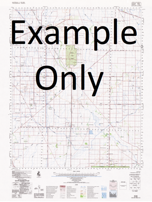
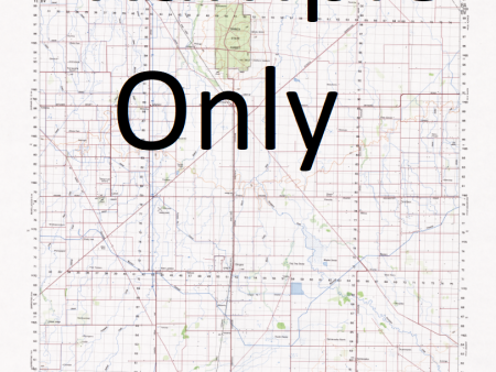
This Topographic Map is produced by Geoscience Australia; Australia s national geospatial organisation.
GA topographic maps (many of which are produced in partnership with the Army) are generally older than those maps produced by the State Governments over the same area. This makes GA maps particularly useful for identifying historic features, such as old mines and diggings.
Geoscience Australia maps generally considered to be more pleasing in design and compilation then the more modern State Government productions.
At this scale, 1cm on this map represents 1km on the ground. A standard map (which is square) covers an area of approximately 54km by 54km, with a contour interval of 20m. This map contains natural and constructed features including road and rail infrastructure, vegetation, hydrography, contours, localities and some administrative boundaries.
Please note the date of the map, as this will impact the currency of information, particularly regarding infrastructure, roads, etc.
Billiatt Roseneath Korah Bore High Prominent Hill Markeri Telegraph Office Timbertop Taplan School Hillview Alawoona Railway Station Wilpy Farm Wilpy Railway Station Tookayerta Ewinbrae Roberta Kumara Tank Moonaroo Coringle Narinya Hundred of Peebinga Moonah Tank Nadda Railway Station Browns Well Meribah Railway Station Valley View Carawatha Kyandra Tiger Bore Paruna Bore Veitch School Moonah Bore Kalbanya Downe Southe Kumara Bore Timber Top Veitch Well Meribah Post Office Enoomah Bore Kringin Peebinga Meribah Malpas Pata Kriggin Alawoona Cockshell Hill View Nadia Browns Well Station Meramba Muljarra Brown Well Jax Joynt Wintrena Butchers Spring Border Park Taplan Railway Station Pine Grove Tiger Tank Vallis Moonah Bore Telephone Office Perkin Dam Alawoona Bore Moona Yundara Prominent Hill Alawoona Tank Merallen Ned Crossing My-Nute Mens Manor Billaweena Dingo Range Peebinga School Pata Railway Station Kieta Mootatunga Paruna Veitch Nadda School Glendoline Kringin Telephone Exchange Hilldale Taplan Post Office Wolowa Hundred of Billiatt Tennson Browns Well District Area School Wolowa Tank Peebinga Rockhole Hill Top Kekwick School Butchers Soak Pines Woodleigh Kringin Railway Station Malvew Markeri School Kringin School Wal s Farm Mulijarra Peebinga Post Office Briaken Park Wolowa Railway Station Roseneath Telephone Office Enoomah BoreTelephone Office Enoomah Bore School Wintrena Railway Station Malpas Railway Station Hiview Sportco Wolowa Bore Marino Crossing Mount Berri Peebinga Wildlife Reserve Jonvalee Moonah Telephone Office Taplan Nalyilta Railway Station Mariam Hundred of Kekwick School Nadda Meribah School Hundred of Kingsford Scrub Pines Telephone Office Joley Pines Pata School Nadda Farms Veitch Railway Station Linwood Ellowar School Alawoona School County of Alfred Smithdale Wilpy Hundred of Bookpurnong Nalya Patahaven Nangaringa Stud Kenrose Pines Reserve Brown Well Bore Labroun Park Rippon Park Ontop Paruna School Paruna Railway Station Stix Farm Hope Butchers Soak School Hundred of McGorrery Peebinga Conservation Park Tennyson Vinedale Kekwick Telephone Office Burford Hill Pearson Waterhole Sylvorn Tookayerta Railway Station Mootatunga Post Office Hundred of Kekwick Glendoune Christmas Valley Nangaringa Hill-Top Moonah Bore School Peebinga Railway Station Kiamonya Nangari Markeri Downe South Krinjin Boltons
Additional Information
| Title | Paper, Laminated |
|---|
Related products


Information
Customer Care
Other Business
Newsletter

linkresortus.shop © 2025 All Rights Reserved