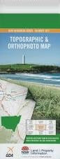
NSW 9441-2S – Grevillia Cheap
Description
This Topographic Map is produced by the New South Wales Government.
This map is supplied in digital in PDF format, which means it can be printed at home or sent to a professional printer for a 100% scale reproduction.
At this scale, 4cm on this map represents 1km on the ground. A standard map (which is square) covers an area of approximately about 12.5km by 12.5km, with a contour interval of 10m. This map contains natural and constructed features including road and rail infrastructure, vegetation, hydrography, contours, localities and some administrative boundaries.
Avalon Glen Erin Glenarvon Treberth Unumgar The Gorge The Billabong Kildare Riverview Calamia Pinewood Gilgal Rosevilla Figtree Brooklyn Lionview Mount Lion Range View Rosedale Dowan Hill Orsova The Willows Avonleigh The Gap Carribee The Meadows Camberra Creek The Cape Railway Station Cedar Getters Creek Cougal Dennis Scrub Creek Ferndale Creek Findon Findon Creek Mount Glennie Gorge Creek Gradys Creek Grevillia Grevillia Gorge Mount Grevillia Grevillia Public School Gullyvul Peak Gullyvul Spring Hoppindick Creek Hungry Gully Mount Ida Imesons Johnstons Gully Findon Creek Public School Fords Creek Grevillias Mill Horseshoe Spur Imerson Imersons Kurrajong Creek Lemon Creek Lindesay View Lindsay View Lion Lion Mount Little O Donnel Creek Loadstone Loadstone Public School Loadstone Railway Station Long Creek Middle Mount Mount Lion Public School Mount Lion Railway Station Murray Scrub Flora Reserve North Branch North Peak Oakey Creek Oaky Creek Old Grevillia Palm Gully Razorback Saddle The Razorback Richmond River The Risk Railway Station Roseberry Roseberry Creek Rukenvale Rukenvale Public School Sherwood Tayling Creek Terrace Creek The Risk The Risk Public School Toonumbar National Forest Waterhole Creek Dourrigans Gap Bundgeam Bundgeam Public School Moore Park Nature Reserve Roseberry State Forest Lynchs Creek Sheepstation Creek Loadstone Station Brindle Creek Mount Lion Station Warrazambil Creek The Cape Collins Creek
Additional Information
| Title | Pdf Download |
|---|
Related products


linkresortus.shop © 2025 All Rights Reserved